

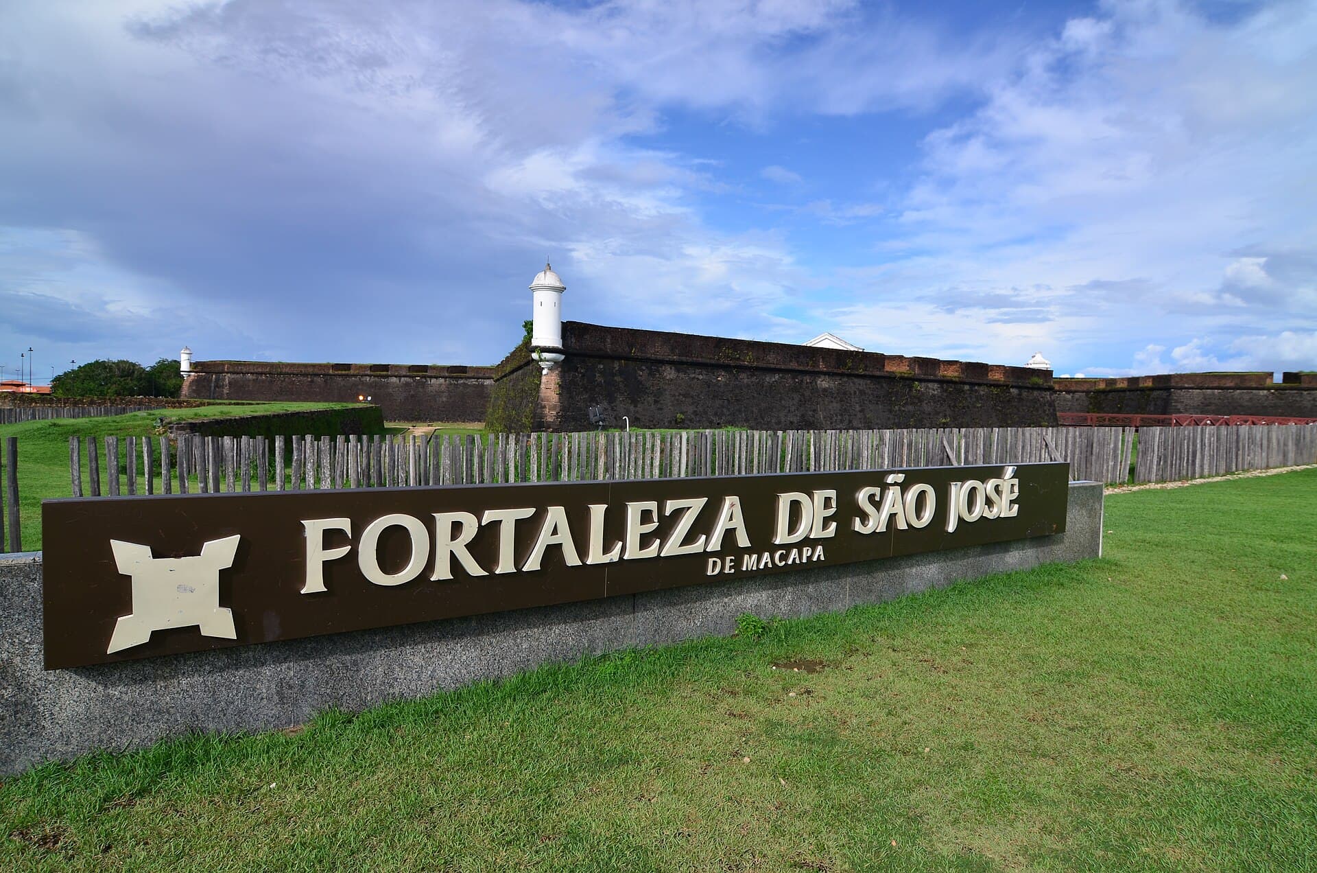
The short answer: Divide Macapá into two clusters. Walk the riverfront and historic core together, with the Fortaleza de São José as the main interpretive stop. Visit the Marco Zero area as a separate outing because it sits away from that compact cluster. This gives each place enough time and avoids crossing the city repeatedly for photographs that explain little on their own.
For statewide context, start with the Amapá first-time travel guide. The Amapá destination directory links that overview to this focused Macapá article.
Understand the two stories before mapping the day
The riverfront cluster tells a story about defense, settlement, port activity, and Macapá's relationship with the Amazon River. The equator cluster tells a geographic and civic story about the city's position across latitude zero. They belong in the same trip, but they do not need to be forced into one uninterrupted walk.
Iphan identifies the Fortaleza de São José as protected military architecture and records its current cultural use. The agency's 2026 fortifications page says the fort was inaugurated in 1782 and is managed as a culture and leisure space by the state foundation. A separate Ministry of Tourism page identifies Macapá as the Brazilian capital crossed by the Equator and describes the Marco Zero monument. Those official sources justify the two anchors. They do not guarantee that every interior, exhibition, or viewing area will be open on your date.
Use the anchors to filter secondary stops. In the historic core, add a market, church, museum, or public square only when it helps explain the river city around the fort. Near Marco Zero, add a park or cultural space only after checking how it operates now. The result should feel like two readable chapters, not a scavenger hunt.
Walk the riverfront and fortress as one cluster
Begin in daylight near the central riverfront. The Amazon is not a distant backdrop here; it is the geographic fact that makes the fort's position intelligible. Orient yourself along the water, then approach the fort from outside before entering. Its relationship to the river, walls, ditch, and surrounding public space is easier to read before you focus on individual rooms.
Iphan's Amapá heritage page explains that the fort was built in the eighteenth century with Black and Indigenous labor and notes its defensive works. That history deserves more than a quick caption. If an official guided visit is available, ask what parts of the structure are original, which were restored, how archaeology changed the interpretation, and how the site was used after its military period.
The fort has undergone restoration work, and access can change by phase. Check the administering foundation or current state culture channel for:
- visitor days and last admission;
- which internal areas are accessible;
- whether a tour requires scheduling;
- temporary work, events, or restricted zones;
- accessibility conditions for the route you plan to use.
After the fort, keep the rest of the cluster compact. The central market and nearby riverfront spaces may help connect heritage to daily city life, but verify current operations and use normal city awareness. Avoid planning the walk around a restaurant name or an old event schedule.
Give Marco Zero its own outing
The Marco Zero do Equador is not an extension of the fort walk. Treat it as a separate ride and decide whether you want a simple geographic stop, a longer visit to the adjacent public area, or an equinox-related program on an officially announced date.
Macapá's municipal Parque Meio do Mundo page places the park beside the monument and provides current public-space context. The Ministry of Tourism's Macapá page explains the basic purpose of the marker. Neither source should be stretched into claims about demonstrations or physical effects that it does not support. The monument marks latitude zero; use it to discuss mapping, solar position, and civic identity without repeating tourist myths as science.
Ask the official visitor channel about construction or event restrictions before traveling across the city. The monument area has received public works in recent years, so a photograph or review from another season may show a layout that no longer matches the site. If your trip coincides with a public equinox program, use the published municipal or state schedule rather than guessing the best minute to arrive.
Add culture without reducing it to decoration
Macapá's identity is not contained by two monuments. The Ministry of Tourism and municipal pages also point to Marabaixo, museums, crafts, markets, and Amazonian food. Select one cultural institution that supplies interpretation rather than trying to attach every named attraction to the same day.
Check whether Museu Sacaca or another public museum is open and what exhibitions are operating. A museum visit can place riverside and Indigenous lifeways into a broader Amapá context, but read labels carefully and distinguish a museum representation from a visit to a living community.
Marabaixo is a cultural practice, not a performance that appears whenever a visitor arrives. Attend only a public program announced by its organizers or a legitimate cultural institution. Do not enter community spaces, record people, or publish religious elements without permission. If there is no scheduled event, a museum or official cultural source is a more respectful introduction than asking someone to stage one.
Choose a realistic one-day or two-day version
One full day works if you stay in Macapá and the fort is confirmed open. Use the morning for the historic riverfront cluster, take a break during the strongest heat, and make the Marco Zero outing later. Keep one indoor cultural stop as an alternative if rain or access changes.
Two days are better for travelers who read exhibitions slowly or want a museum:
| Period | Focus | Decision point |
|---|---|---|
| Day 1 morning | Riverfront orientation and fort exterior | Confirm interior access first |
| Day 1 afternoon | Fort collection or nearby cultural venue | Keep the cluster walkable |
| Day 2 morning | Museum or market context | Use current public hours |
| Day 2 later | Marco Zero and adjacent public area | Check works and event notices |
Do not promise yourself a river excursion as filler. Passenger vessels, local tours, and intercity river transport are different services. If you add time on the water, identify the operator, vessel, route, life-saving equipment, departure place, and return in advance.
Plan access for heat, rain, and mobility
Large exposed areas around the fort and Marco Zero can make a short map distance feel demanding. Check the local forecast, carry water, and schedule shade or indoor time. A traveler who uses a wheelchair, cane, or needs frequent seating should request current surface, ramp, restroom, and drop-off information from each site. Heritage protection can constrain routes, and a general claim that a public square is accessible does not prove that every interior is.
Save addresses in writing because similar attraction names and informal pickup points can cause confusion. For each transfer, show the full destination to the driver and confirm whether the return area is easy to identify. If a public event changes traffic, ask the accommodation or official tourist office how that affects the drop-off.
Sources checked
Desk research only, with no on-site inspection by Stopover. The route, visitor surfaces, transfers, and opening conditions have not been field tested. These government sources were checked on August 29, 2026:
- Fortalezas incluídas na Lista Indicativa a Patrimônio Mundial - Iphan; current institutional description of the Fortaleza de São José and its cultural use.
- Patrimônio Material no Amapá - Iphan; construction, labor, restoration, and protected-heritage context.
- Macapá completa 258 anos - Ministry of Tourism; official orientation to the Equator marker and principal city heritage.
- Parque Meio do Mundo - Municipality of Macapá; current municipal description and location of the public park beside Marco Zero.